 LODUR
LODUR
Current Status
Where is the vessel?
LODUR is currently in Near Keratsínion, based on AIS data received about 14h ago.
Latest AIS update:
Current position: 37.95501° N, 23.59511° E (Near Keratsínion)
Average speed (last 7 days): Loading…
Average speed (last 30 days): Loading…
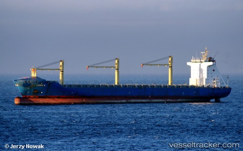
Vessel profile: LODUR is a Container Ship with dimensions m x m.
This page combines live AIS, route history, probable destination signals, nearby traffic, and port activity for practical vessel monitoring.
The current position of vessel LODUR is 37.95501 lat / 23.59511 lng. Updated: 2026-05-19 17:28:32 UTCNearest reference points:
- Near Keratsínion
- Near Drapetzona
- Near PERAMA
Currently sailing under the flag of Portugal ![]()
Details:
Live Vessel LODUR Analytics (details, animations, etc.)
Recent AIS points (UTC):
2026-05-19 14:23:29 UTC · 37.95506, 23.59514 · SOG 0 kn · COG 347°2026-05-19 15:59:27 UTC · 37.95503, 23.59513 · SOG 0 kn · COG 347°
2026-05-19 16:46:33 UTC · 37.95505, 23.59514 · SOG 0 kn · COG 347°
2026-05-19 17:28:32 UTC · 37.95501, 23.59511 · SOG 0 kn · COG 347°