 vesseltracker.com
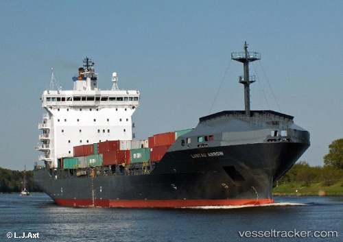
 MORAGA
Current Status
Where is the vessel?
MORAGA is currently in 32 nm E of IGNEADA, based on AIS data received less than 1h ago.
Latest AIS update:
Current position: 41.83210° N, 28.72576° E (32 nm E of IGNEADA)
Average speed (last 7 days): Loading…
Average speed (last 30 days): Loading…
Vessel profile: MORAGA is a Container Ship with dimensions 159m x 26m.
This page combines live AIS, route history, probable destination signals, nearby traffic, and port activity for practical vessel monitoring.
The current position of vessel MORAGA is 41.83210 lat / 28.72576 lng. Updated: 2026-04-28 12:09:23 UTCNearest reference points:
- 38 nm E of IGNEADA
- 18 nm N of Istanbul New Airport
- Near RUMELI FENERI
Currently sailing under the flag of Marshall Islands ![]()
MORAGA built in 2001 year
Deadweight:
14901 tDetails:
Live Vessel MORAGA Analytics (details, animations, etc.)
Recent AIS points (UTC):
2026-04-28 07:43:07 UTC · 42.46904, 27.97073 · SOG 11.7 kn · COG 90°2026-04-28 10:12:43 UTC · 42.10109, 28.44431 · SOG 9.9 kn · COG 140°
2026-04-28 10:14:04 UTC · 42.09814, 28.44729 · SOG 9.9 kn · COG 141°
2026-04-28 12:09:23 UTC · 41.83210, 28.72576 · SOG 11.8 kn · COG 146°