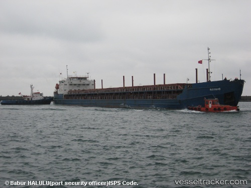
 NAVAHO
Current Status
Where is the vessel?
NAVAHO is currently in Near Azov, based on AIS data received about 17h ago.
Latest AIS update:
Current position: 47.12512° N, 39.37916° E (Near Azov)
Average speed (last 7 days): Loading…
Average speed (last 30 days): Loading…
Vessel profile: NAVAHO is a General Cargo with dimensions m x m.
This page combines live AIS, route history, probable destination signals, nearby traffic, and port activity for practical vessel monitoring.
The current position of vessel NAVAHO is 47.12512 lat / 39.37916 lng. Updated: 2026-05-19 18:42:28 UTCNearest reference points:
- Near Azov
- 11 nm W of Azov
- Near Rostov-na-Donu
Currently sailing under the flag of Liberia ![]()
Details:
Live Vessel NAVAHO Analytics (details, animations, etc.)
Recent AIS points (UTC):
2026-05-19 18:42:28 UTC · 47.12512, 39.37916 · SOG 7.8 kn · COG 198°2026-05-19 18:42:28 UTC · 47.12512, 39.37916 · SOG 7.8 kn · COG 198°
2026-05-19 18:42:28 UTC · 47.12512, 39.37916 · SOG 7.8 kn · COG 198°
2026-05-19 18:42:28 UTC · 47.12512, 39.37916 · SOG 7.8 kn · COG 198°