 NEW LIBERTY
Current Status
Where is the vessel?
NEW LIBERTY is currently in 71 nm SW of Al Muajjiz, based on AIS data received about 14h ago.
Latest AIS update:
Current position: 22.49867° N, 37.65290° E (71 nm SW of Al Muajjiz)
Average speed (last 7 days): Loading…
Average speed (last 30 days): Loading…
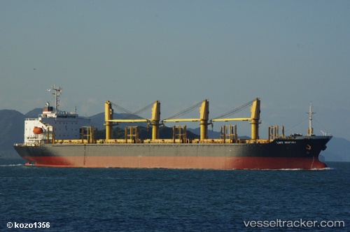
Vessel profile: NEW LIBERTY is a Bulk Carrier with dimensions m x m.
This page combines live AIS, route history, probable destination signals, nearby traffic, and port activity for practical vessel monitoring.
The current position of vessel NEW LIBERTY is 22.49867 lat / 37.65290 lng. Updated: 2026-07-03 06:14:06 UTCNearest reference points:
- 65 nm SW of King Abdullah City
- 95 nm SW of Al Muajjiz
- 67 nm W of Tusdeer Free Zone
Currently sailing under the flag of Barbados ![]()
Details:
Live Vessel NEW LIBERTY Analytics (details, animations, etc.)
Recent AIS points (UTC):
2026-07-03 01:28:36 UTC · 21.78487, 38.25696 · SOG 11.7 kn · COG 324°2026-07-03 03:57:06 UTC · 22.11670, 37.99670 · SOG 14 kn · COG 0°
2026-07-03 04:14:13 UTC · 22.21302, 37.91364 · SOG 11.3 kn · COG 321°
2026-07-03 06:14:06 UTC · 22.49867, 37.65290 · SOG 11.1 kn · COG 323°