 KITAKAZE
Current Status
Where is the vessel?
KITAKAZE is currently in 248 nm E of Puerto Deseado, based on AIS data received about 14h ago.
Latest AIS update:
Current position: 46.13386° S, 60.36099° W (248 nm E of Puerto Deseado)
Average speed (last 7 days): Loading…
Average speed (last 30 days): Loading…
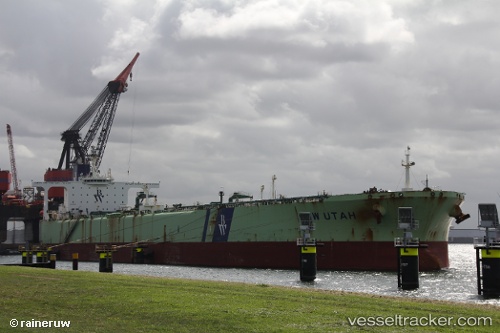
Vessel profile: KITAKAZE is a Crude Oil Tanker with dimensions m x m.
This page combines live AIS, route history, probable destination signals, nearby traffic, and port activity for practical vessel monitoring.
The current position of vessel KITAKAZE is -46.13386 lat / -60.36099 lng. Updated: 2026-06-19 04:28:38 UTCCurrently sailing under the flag of Tanzania ![]()
Details:
Live Vessel KITAKAZE Analytics (details, animations, etc.)
Recent AIS points (UTC):
2026-06-19 01:39:35 UTC · -46.13509, -60.36125 · SOG 2 kn · COG -1°2026-06-19 02:40:00 UTC · -46.13503, -60.36094 · SOG 2.4 kn · COG -1°
2026-06-19 03:29:18 UTC · -46.13487, -60.36089 · SOG 0.7 kn · COG -1°
2026-06-19 04:28:38 UTC · -46.13386, -60.36099 · SOG 1.9 kn · COG -1°