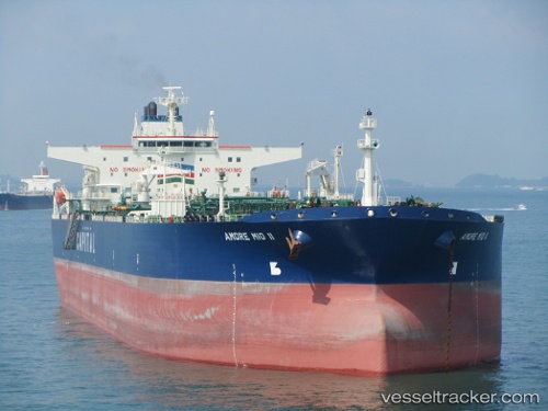
Sarak
Current StatusWhere is the vessel?
Sarak is currently in 39 nm SW of Kiamari, based on AIS data received about 14h ago.
Latest AIS update:
Current position: 24.25510° N, 66.61413° E (39 nm SW of Kiamari)
Average speed (last 7 days): Loading…
Average speed (last 30 days): Loading…
Vessel profile: Sarak is a Crude Oil Tanker with dimensions 48m x 273m.
This page combines live AIS, route history, probable destination signals, nearby traffic, and port activity for practical vessel monitoring.
The current position of vessel Sarak is 24.25510 lat / 66.61413 lng. Updated: 2026-05-27 09:31:37 UTCNearest reference points:
- 16 nm S of Kiamari
- Near Kiamari
- Near PORT QASIM
Details:
Live Vessel Sarak Analytics (details, animations, etc.)
Recent AIS points (UTC):
2026-05-27 06:04:37 UTC · 23.94287, 66.59395 · SOG 5.6 kn · COG 357°2026-05-27 07:25:26 UTC · 24.06573, 66.60208 · SOG 5.4 kn · COG 356°
2026-05-27 08:16:47 UTC · 24.14277, 66.60602 · SOG 5.3 kn · COG 354°
2026-05-27 09:31:37 UTC · 24.25510, 66.61413 · SOG 5.4 kn · COG 358°