 Missouriborg
Current Status
Where is the vessel?
Missouriborg is currently in Near PORTAVOGIE, based on AIS data received about 14h ago.
Latest AIS update:
Current position: 54.44268° N, 5.24238° W (Near PORTAVOGIE)
Average speed (last 7 days): Loading…
Average speed (last 30 days): Loading…
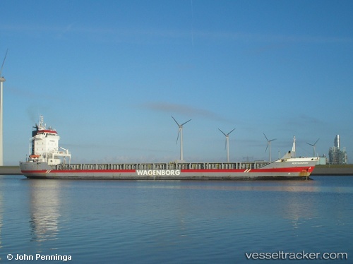
Vessel profile: Missouriborg is a General Cargo Ship with dimensions 134m x 17m.
This page combines live AIS, route history, probable destination signals, nearby traffic, and port activity for practical vessel monitoring.
The current position of vessel Missouriborg is 54.44268 lat / -5.24238 lng. Updated: 2026-05-22 02:33:53 UTCNearest reference points:
- Near Crossgar
- Near Belfast
- Near Girvan
Currently sailing under the flag of Netherlands ![]()
Missouriborg built in 2000 year
Deadweight:
9150 tDetails:
Live Vessel Missouriborg Analytics (details, animations, etc.)
Recent AIS points (UTC):
2026-05-21 22:07:31 UTC · 55.26896, -6.00942 · SOG 12.6 kn · COG 144°2026-05-21 22:22:42 UTC · 55.22440, -5.95435 · SOG 13.3 kn · COG 144°
2026-05-22 01:21:12 UTC · 54.67968, -5.35852 · SOG 13.1 kn · COG 162°
2026-05-22 02:33:53 UTC · 54.44268, -5.24238 · SOG 11.6 kn · COG 159°