 vesseltracker.com
 SENTOSA 66
Current Status
Where is the vessel?
SENTOSA 66 is currently in 97 nm S of Preobrazheniye, based on AIS data received about 14h ago.
Latest AIS update:
Current position: 41.38923° N, 134.65392° E (97 nm S of Preobrazheniye)
Average speed (last 7 days): Loading…
Average speed (last 30 days): Loading…
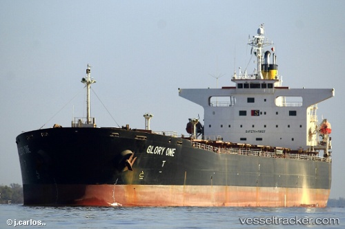
Vessel profile: SENTOSA 66 is a Bulk Carrier with dimensions 224m x 32m.
This page combines live AIS, route history, probable destination signals, nearby traffic, and port activity for practical vessel monitoring.
The current position of vessel SENTOSA 66 is 41.38923 lat / 134.65392 lng. Updated: 2026-05-18 03:25:43 UTCNearest reference points:
- 46 nm SE of Vrangel'
- 29 nm SE of Vrangel'
- 35 nm S of Vrangel'
Currently sailing under the flag of Panama ![]()
SENTOSA 66 built in 2002 year
Deadweight:
73180 tDetails:
Live Vessel SENTOSA 66 Analytics (details, animations, etc.)
Recent AIS points (UTC):
2026-05-17 23:32:01 UTC · 40.68822, 134.05937 · SOG 13.2 kn · COG 31°2026-05-18 00:02:43 UTC · 40.78492, 134.13789 · SOG 13.2 kn · COG 34°
2026-05-18 00:02:43 UTC · 40.78492, 134.13789 · SOG 13.2 kn · COG 34°
2026-05-18 03:25:43 UTC · 41.38923, 134.65392 · SOG 12.7 kn · COG 31°