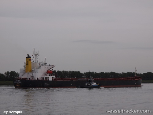
Maha Roos
Current StatusWhere is the vessel?
Maha Roos is currently in 16 nm NE of SHINAS, based on AIS data received about 14h ago.
Latest AIS update:
Current position: 24.92825° N, 56.68963° E (16 nm NE of SHINAS)
Average speed (last 7 days): Loading…
Average speed (last 30 days): Loading…
Vessel profile: Maha Roos is a Bulk Carrier with dimensions 32m x 225m.
This page combines live AIS, route history, probable destination signals, nearby traffic, and port activity for practical vessel monitoring.
The current position of vessel Maha Roos is 24.92825 lat / 56.68963 lng. Updated: 2026-07-09 05:58:50 UTCNearest reference points:
- 18 nm SE of SHINAS
- Near Fujairah
- Near Offshore Fujairah
Details:
Live Vessel Maha Roos Analytics (details, animations, etc.)
Recent AIS points (UTC):
2026-07-09 02:51:46 UTC · 24.62073, 56.67462 · SOG 0 kn · COG 181°2026-07-09 03:40:37 UTC · 24.62066, 56.67481 · SOG 7 kn · COG -1°
2026-07-09 05:06:01 UTC · 24.76380, 56.72830 · SOG 11.6 kn · COG 1°
2026-07-09 05:58:50 UTC · 24.92825, 56.68963 · SOG 11.4 kn · COG 336°