 HY GLORY
Current Status
Where is the vessel?
HY GLORY is currently in 24 nm W of Puerto Princesa, based on AIS data received about 15h ago.
Latest AIS update:
Current position: 9.65428° N, 118.32301° E (24 nm W of Puerto Princesa)
Average speed (last 7 days): Loading…
Average speed (last 30 days): Loading…
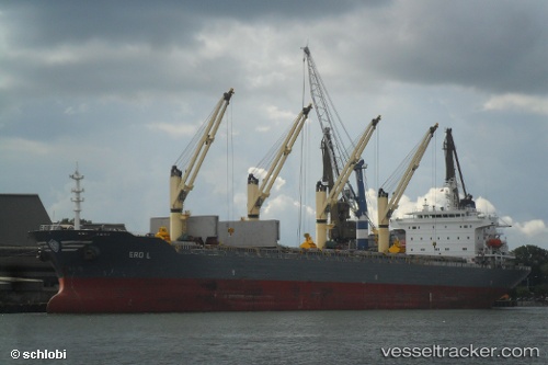
Vessel profile: HY GLORY is a Bulk Carrier with dimensions 32m x 190m.
This page combines live AIS, route history, probable destination signals, nearby traffic, and port activity for practical vessel monitoring.
The current position of vessel HY GLORY is 9.65428 lat / 118.32301 lng. Updated: 2026-05-20 23:59:57 UTCNearest reference points:
- 70 nm W of Puerto Princesa
- 35 nm SE of Brookes Point, Palawan
- 43 nm W of Malampaya
Currently sailing under the flag of Panama ![]()
HY GLORY built in 2003 year
Deadweight:
50457 tDetails:
Live Vessel HY GLORY Analytics (details, animations, etc.)
Recent AIS points (UTC):
2026-05-20 19:11:57 UTC · 9.65461, 118.32395 · SOG 0 kn · COG 166°2026-05-20 21:59:57 UTC · 9.65459, 118.32438 · SOG 0 kn · COG 191°
2026-05-20 21:59:57 UTC · 9.65459, 118.32438 · SOG 0 kn · COG 191°
2026-05-20 23:59:57 UTC · 9.65428, 118.32301 · SOG 0.1 kn · COG 139°