 Seaways Rubymar
Current Status
Where is the vessel?
Seaways Rubymar is currently in Open sea, approx. 412 nm off the nearest listed port, based on AIS data received about 139d ago.
Latest AIS update:
Current position: 86.07744° N, 5.44819° E (Open sea, approx. 412 nm off the nearest listed port)
Average speed (last 7 days): Loading…
Average speed (last 30 days): Loading…
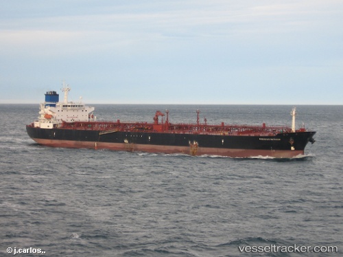
Vessel profile: Seaways Rubymar is a Crude Oil Tanker with dimensions 228m x 32m.
This page combines live AIS, route history, probable destination signals, nearby traffic, and port activity for practical vessel monitoring.
The current position of vessel Seaways Rubymar is 86.07744 lat / 5.44819 lng. Updated: 2026-02-25 10:07:01 UTCNearest reference points:
- Open sea, approx. 412 nm off the nearest listed port
- Open sea, approx. 408 nm off the nearest listed port
- Open sea, approx. 401 nm off the nearest listed port
Currently sailing under the flag of Marshall Is ![]()
Seaways Rubymar built in 2002 year
Deadweight:
69599 tDetails:
Live Vessel Seaways Rubymar Analytics (details, animations, etc.)
Recent AIS points (UTC):
2026-02-25 10:07:01 UTC · 86.07744, 5.44819 · SOG 98.4 kn · COG 0°