 EAST HELIOS
Current Status
Where is the vessel?
EAST HELIOS is currently in Near Taku Bar, based on AIS data received about 15h ago.
Latest AIS update:
Current position: 38.89017° N, 118.08033° E (Near Taku Bar)
Average speed (last 7 days): Loading…
Average speed (last 30 days): Loading…
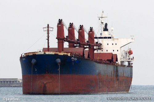
Vessel profile: EAST HELIOS is a Bulk Carrier with dimensions m x m.
This page combines live AIS, route history, probable destination signals, nearby traffic, and port activity for practical vessel monitoring.
The current position of vessel EAST HELIOS is 38.89017 lat / 118.08033 lng. Updated: 2026-05-20 22:19:53 UTCNearest reference points:
- Near Dagu Bar
- Near Taku Bar
- Near Tianjin Pt
Currently sailing under the flag of Vanuatu ![]()
Details:
Live Vessel EAST HELIOS Analytics (details, animations, etc.)
Recent AIS points (UTC):
2026-05-20 17:34:46 UTC · 38.89117, 118.07617 · SOG 0 kn · COG 95°2026-05-20 19:09:53 UTC · 38.89083, 118.07633 · SOG 0 kn · COG 79°
2026-05-20 21:40:50 UTC · 38.88983, 118.08017 · SOG 0 kn · COG 307°
2026-05-20 22:19:53 UTC · 38.89017, 118.08033 · SOG 0 kn · COG 295°