 vesseltracker.com
 MONTARA
Current Status
Where is the vessel?
MONTARA is currently in Near BAKIRKOY, based on AIS data received about 2h ago.
Latest AIS update:
Current position: 40.94208° N, 28.87821° E (Near BAKIRKOY)
Average speed (last 7 days): Loading…
Average speed (last 30 days): Loading…
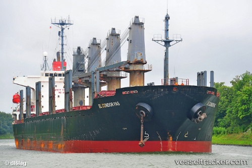
Vessel profile: MONTARA is a Bulk Carrier with dimensions 176m x 27m.
This page combines live AIS, route history, probable destination signals, nearby traffic, and port activity for practical vessel monitoring.
The current position of vessel MONTARA is 40.94208 lat / 28.87821 lng. Updated: 2026-04-27 11:28:13 UTCNearest reference points:
- Near BAKIRKOY
- Near ZEYTINBURNU
- Near Davutpasa
Currently sailing under the flag of Barbados ![]()
MONTARA built in 2001 year
Deadweight:
33476 tDetails:
Live Vessel MONTARA Analytics (details, animations, etc.)
Recent AIS points (UTC):
2026-04-27 07:44:53 UTC · 40.94218, 28.87806 · SOG 0.1 kn · COG 52°2026-04-27 09:56:44 UTC · 40.94217, 28.87812 · SOG 0.1 kn · COG 62°
2026-04-27 10:13:06 UTC · 40.94220, 28.87808 · SOG 0.1 kn · COG 64°
2026-04-27 11:28:13 UTC · 40.94208, 28.87821 · SOG 0.1 kn · COG 63°