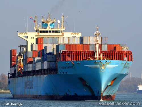
 Maersk Gironde
Current Status
Where is the vessel?
Maersk Gironde is currently in Near Bremerhaven-Speckenbüttel, based on AIS data received about 14h ago.
Latest AIS update:
Current position: 53.59693° N, 8.51670° E (Near Bremerhaven-Speckenbüttel)
Average speed (last 7 days): Loading…
Average speed (last 30 days): Loading…
Vessel profile: Maersk Gironde is a Container Ship with dimensions 292m x 32m.
This page combines live AIS, route history, probable destination signals, nearby traffic, and port activity for practical vessel monitoring.
The current position of vessel Maersk Gironde is 53.59693 lat / 8.51670 lng. Updated: 2026-05-19 00:05:06 UTCNearest reference points:
- Near Bremerhaven
- Near Sandstedt
- Near Brake
Currently sailing under the flag of Singapore ![]()
Maersk Gironde built in 2002 year
Deadweight:
61636 tDetails:
Live Vessel Maersk Gironde Analytics (details, animations, etc.)
Recent AIS points (UTC):
2026-05-18 20:20:04 UTC · 53.59701, 8.51663 · SOG 0 kn · COG 141°2026-05-18 21:44:03 UTC · 53.59696, 8.51676 · SOG 0 kn · COG 139°
2026-05-18 22:59:06 UTC · 53.59700, 8.51668 · SOG 0 kn · COG 139°
2026-05-19 00:05:06 UTC · 53.59693, 8.51670 · SOG 0 kn · COG 140°