 AN HAI
Current Status
Where is the vessel?
AN HAI is currently in 118 nm E of Port Raysut, based on AIS data received about 14h ago.
Latest AIS update:
Current position: 16.66794° N, 56.05863° E (118 nm E of Port Raysut)
Average speed (last 7 days): Loading…
Average speed (last 30 days): Loading…
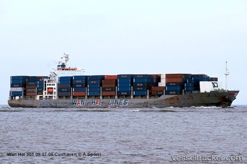
Vessel profile: AN HAI is a Container Ship with dimensions m x m.
This page combines live AIS, route history, probable destination signals, nearby traffic, and port activity for practical vessel monitoring.
The current position of vessel AN HAI is 16.66794 lat / 56.05863 lng. Updated: 2026-05-22 03:40:18 UTCNearest reference points:
- 91 nm S of Pizhou
- 103 nm S of Port Raysut
- 39 nm SE of Pizhou
Currently sailing under the flag of Panama ![]()
Details:
Live Vessel AN HAI Analytics (details, animations, etc.)
Recent AIS points (UTC):
2026-05-21 22:19:54 UTC · 15.76276, 55.04373 · SOG 15.4 kn · COG 46°2026-05-22 01:47:30 UTC · 16.36044, 55.69961 · SOG 14.8 kn · COG 50°
2026-05-22 02:23:42 UTC · 16.46088, 55.81349 · SOG 14.7 kn · COG 50°
2026-05-22 03:40:18 UTC · 16.66794, 56.05863 · SOG 14.8 kn · COG 53°