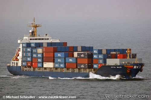
 HARBOUR ICONIC
Current Status
Where is the vessel?
HARBOUR ICONIC is currently in 14 nm W of SUNGAI UDANG, based on AIS data received about 14h ago.
Latest AIS update:
Current position: 2.26653° N, 101.89960° E (14 nm W of SUNGAI UDANG)
Average speed (last 7 days): Loading…
Average speed (last 30 days): Loading…
Vessel profile: HARBOUR ICONIC is a Container Ship with dimensions m x m.
This page combines live AIS, route history, probable destination signals, nearby traffic, and port activity for practical vessel monitoring.
The current position of vessel HARBOUR ICONIC is 2.26653 lat / 101.89960 lng. Updated: 2026-06-22 10:14:06 UTCNearest reference points:
- 14 nm W of SUNGAI UDANG
- Near SUNGAI UDANG
- Near PORT DICKSON
Currently sailing under the flag of Malaysia ![]()
Details:
Live Vessel HARBOUR ICONIC Analytics (details, animations, etc.)
Recent AIS points (UTC):
2026-06-22 07:47:36 UTC · 1.94063, 102.30532 · SOG 12.2 kn · COG 296°2026-06-22 07:56:17 UTC · 1.95672, 102.28120 · SOG 12 kn · COG 304°
2026-06-22 09:47:56 UTC · 2.20432, 101.97593 · SOG 13.3 kn · COG 310°
2026-06-22 10:14:06 UTC · 2.26653, 101.89960 · SOG 13.6 kn · COG 307°