 vesseltracker.com
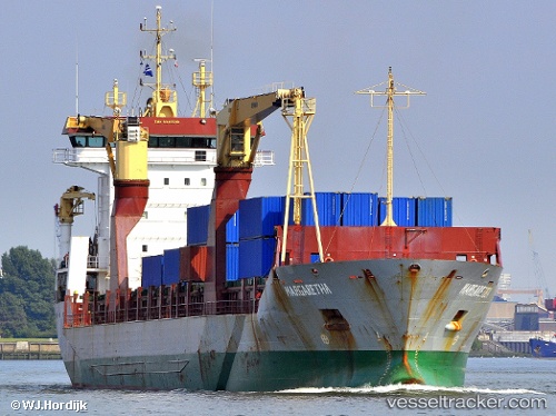
 Margaretha
Current Status
Where is the vessel?
Margaretha is currently in 65 nm SE of Alcobaca, based on AIS data received less than 1h ago.
Latest AIS update:
Current position: 18.26685° S, 38.38235° W (65 nm SE of Alcobaca)
Average speed (last 7 days): Loading…
Average speed (last 30 days): Loading…
Vessel profile: Margaretha is a Multi Purpose Carrier with dimensions 145m x 19m.
This page combines live AIS, route history, probable destination signals, nearby traffic, and port activity for practical vessel monitoring.
The current position of vessel Margaretha is -18.26685 lat / -38.38235 lng. Updated: 2026-05-14 06:07:20 UTCNearest reference points:
- 91 nm E of Conceicao da Barra
- 169 nm E of Alcobaca
- 66 nm NE of Espírito Santo FPSO
Currently sailing under the flag of Antigua Barbuda ![]()
Margaretha built in 2002 year
Deadweight:
10526 tDetails:
Live Vessel Margaretha Analytics (details, animations, etc.)
Recent AIS points (UTC):
2026-05-14 02:50:01 UTC · -17.75275, -38.11723 · SOG 10.8 kn · COG 198°2026-05-14 03:25:02 UTC · -17.84894, -38.15519 · SOG 10.5 kn · COG 201°
2026-05-14 04:03:41 UTC · -17.95068, -38.20762 · SOG 10.3 kn · COG 206°
2026-05-14 06:07:20 UTC · -18.26685, -38.38235 · SOG 10.2 kn · COG 208°