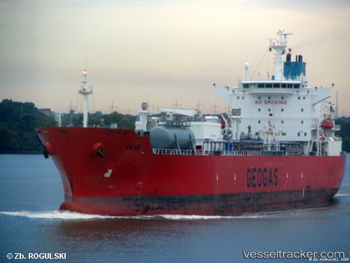
 EMILIA
Current Status
Where is the vessel?
EMILIA is currently in Near Habana, based on AIS data received about 11d ago.
Latest AIS update:
Current position: 23.13518° N, 82.32933° W (Near Habana)
Average speed (last 7 days): Loading…
Average speed (last 30 days): Loading…
Vessel profile: EMILIA is a LPG Tanker with dimensions 178m x 177m.
This page combines live AIS, route history, probable destination signals, nearby traffic, and port activity for practical vessel monitoring.
The current position of vessel EMILIA is 23.13518 lat / -82.32933 lng. Updated: 2026-05-10 03:40:08 UTCNearest reference points:
- Near ALAMEDA DEL SIBONEY
- Near Mariel
- 40 nm S of Florida Straits
Currently sailing under the flag of Cuba ![]()
EMILIA built in 2002 year
Deadweight:
28095 tDetails:
Live Vessel EMILIA Analytics (details, animations, etc.)
Recent AIS points (UTC):
2026-05-10 03:40:08 UTC · 23.13518, -82.32933 · SOG 0 kn · COG 110°2026-05-10 03:40:08 UTC · 23.13518, -82.32933 · SOG 0 kn · COG 110°
2026-05-10 03:40:08 UTC · 23.13518, -82.32933 · SOG 0 kn · COG 110°
2026-05-10 03:40:08 UTC · 23.13518, -82.32933 · SOG 0 kn · COG 110°