 Aurette A
Current Status
Where is the vessel?
Aurette A is currently in 103 nm NW of Ad Dakhla, based on AIS data received about 15h ago.
Latest AIS update:
Current position: 25.09340° N, 17.02710° W (103 nm NW of Ad Dakhla)
Average speed (last 7 days): Loading…
Average speed (last 30 days): Loading…
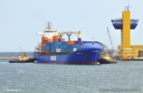
Vessel profile: Aurette A is a Container Ship with dimensions 155m x 24m.
This page combines live AIS, route history, probable destination signals, nearby traffic, and port activity for practical vessel monitoring.
The current position of vessel Aurette A is 25.0934 lat / -17.0271 lng. Updated: 2026-06-23 07:20:30 UTCNearest reference points:
- 110 nm NE of Las Brujas
- 68 nm NW of Ad Dakhla
- Near DAKHLA
Currently sailing under the flag of Malta ![]()
Aurette A built in 2002 year
Deadweight:
17275 tDetails:
Live Vessel Aurette A Analytics (details, animations, etc.)
Recent AIS points (UTC):
2026-06-23 04:22:45 UTC · 24.59630, -17.26630 · SOG 10.8 kn · COG -1°2026-06-23 06:11:13 UTC · 24.90250, -17.14220 · SOG 10.8 kn · COG -1°
2026-06-23 06:59:32 UTC · 25.03770, -17.06100 · SOG 10.8 kn · COG 28°
2026-06-23 07:20:30 UTC · 25.09340, -17.02710 · SOG 10.5 kn · COG 27°