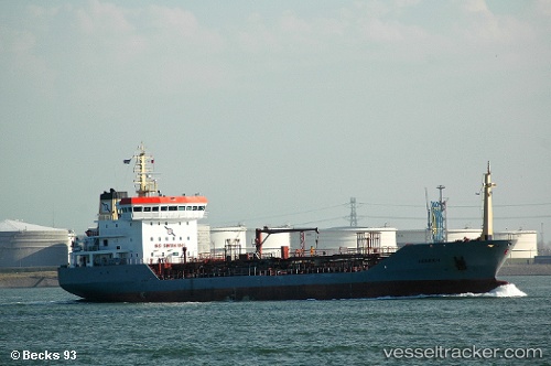
 BRAVE
BRAVE
Current Status
Where is the vessel?
BRAVE is currently in 74 nm SW of Chah Bahar, based on AIS data received about 3d ago.
Latest AIS update:
Current position: 24.23820° N, 59.85081° E (74 nm SW of Chah Bahar)
Average speed (last 7 days): Loading…
Average speed (last 30 days): Loading…
Vessel profile: BRAVE is a Chemical Oil Products Tanker with dimensions 114m x 17m.
This page combines live AIS, route history, probable destination signals, nearby traffic, and port activity for practical vessel monitoring.
The current position of vessel BRAVE is 24.23820 lat / 59.85081 lng. Updated: 2026-05-19 17:33:56 UTCNearest reference points:
- 59 nm S of Chah Bahar
- 23 nm NE of Qalhat
- 52 nm NE of SUR
Currently sailing under the flag of Barbados ![]()
BRAVE built in 2002 year
Deadweight:
6711 tDetails:
Live Vessel BRAVE Analytics (details, animations, etc.)
Recent AIS points (UTC):
2026-05-19 17:33:56 UTC · 24.23820, 59.85081 · SOG 9.6 kn · COG 276°2026-05-19 17:33:56 UTC · 24.23820, 59.85081 · SOG 9.6 kn · COG 276°
2026-05-19 17:33:56 UTC · 24.23820, 59.85081 · SOG 9.6 kn · COG 276°
2026-05-19 17:33:56 UTC · 24.23820, 59.85081 · SOG 9.6 kn · COG 276°