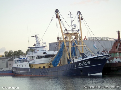
Z 296
Current StatusWhere is the vessel?
Z 296 is currently in Near Flushing, based on AIS data received about 15h ago.
Latest AIS update:
Current position: 51.44644° N, 3.58955° E (Near Flushing)
Average speed (last 7 days): Loading…
Average speed (last 30 days): Loading…
Vessel profile: Z 296 is a Fishing Vessel with dimensions 9m x 38m.
This page combines live AIS, route history, probable destination signals, nearby traffic, and port activity for practical vessel monitoring.
The current position of vessel Z 296 is 51.44644 lat / 3.58955 lng. Updated: 2026-05-24 05:39:10 UTCNearest reference points:
- Near Flushing
- Near BRESKENS
- Near Oost-Souburg
Details:
Live Vessel Z 296 Analytics (details, animations, etc.)
Recent AIS points (UTC):
2026-05-24 01:38:59 UTC · 51.44642, 3.58958 · SOG 0 kn · COG 194°2026-05-24 04:06:08 UTC · 51.44643, 3.58959 · SOG 0 kn · COG 193°
2026-05-24 04:25:29 UTC · 51.44644, 3.58957 · SOG 0 kn · COG 194°
2026-05-24 05:39:10 UTC · 51.44644, 3.58955 · SOG 0 kn · COG 194°