 ASTORIA
Current Status
Where is the vessel?
ASTORIA is currently in 17 nm SE of Sulina (Port et Zone Franche), based on AIS data received about 14h ago.
Latest AIS update:
Current position: 44.99670° N, 30.00090° E (17 nm SE of Sulina (Port et Zone Franche))
Average speed (last 7 days): Loading…
Average speed (last 30 days): Loading…
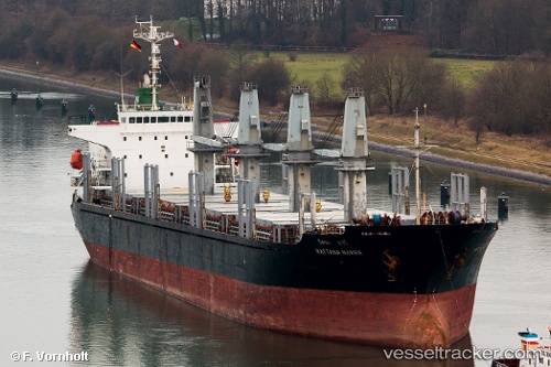
Vessel profile: ASTORIA is a Bulk Carrier with dimensions m x m.
This page combines live AIS, route history, probable destination signals, nearby traffic, and port activity for practical vessel monitoring.
The current position of vessel ASTORIA is 44.99670 lat / 30.00090 lng. Updated: 2026-05-20 09:35:29 UTCNearest reference points:
- 13 nm E of Sulina (Port et Zone Franche)
- 12 nm SE of Sulina (Port et Zone Franche)
- Near Ust-Dunaisk/Vylkove
Currently sailing under the flag of Palau ![]()
Details:
Live Vessel ASTORIA Analytics (details, animations, etc.)
Recent AIS points (UTC):
2026-05-20 07:32:29 UTC · 44.99697, 30.00115 · SOG 0 kn · COG 346°2026-05-20 08:14:29 UTC · 44.99685, 30.00072 · SOG 0.1 kn · COG 347°
2026-05-20 09:35:29 UTC · 44.99670, 30.00090 · SOG 7.7 kn · COG 338°
2026-05-20 09:35:29 UTC · 44.99670, 30.00090 · SOG 7.7 kn · COG 338°