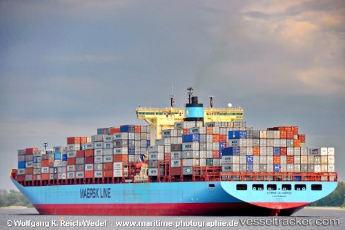
 Cornelia Maersk
Current Status
Where is the vessel?
Cornelia Maersk is currently in Open sea (no nearby ports in database), based on AIS data received about 15h ago.
Latest AIS update:
Current position: 19.07167° S, 1.38667° E (Open sea (no nearby ports in database))
Average speed (last 7 days): Loading…
Average speed (last 30 days): Loading…
Vessel profile: Cornelia Maersk is a Container Ship with dimensions 347m x 42m.
This page combines live AIS, route history, probable destination signals, nearby traffic, and port activity for practical vessel monitoring.
The current position of vessel Cornelia Maersk is -19.07167 lat / 1.38667 lng. Updated: 2026-05-21 01:45:55 UTCNearest reference points:
- Open sea (no nearby ports in database)
- Open sea, approx. 440 nm off the nearest listed port
- Open sea, approx. 437 nm off the nearest listed port
Currently sailing under the flag of Denmark ![]()
Cornelia Maersk built in 2002 year
Deadweight:
104600 tDetails:
Live Vessel Cornelia Maersk Analytics (details, animations, etc.)
Recent AIS points (UTC):
2026-05-20 23:03:33 UTC · -19.65167, 2.05833 · SOG 19 kn · COG -1°2026-05-20 23:24:35 UTC · -19.57667, 1.97167 · SOG 19 kn · COG -1°
2026-05-21 01:27:54 UTC · -19.13614, 1.46192 · SOG 19.2 kn · COG 313°
2026-05-21 01:45:55 UTC · -19.07167, 1.38667 · SOG 19 kn · COG -1°