 vesseltracker.com
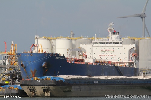
 PORT CAPRI
Current Status
Where is the vessel?
PORT CAPRI is currently in Near DORTYOL, based on AIS data received about 1h ago.
Latest AIS update:
Current position: 36.85446° N, 36.12913° E (Near DORTYOL)
Average speed (last 7 days): Loading…
Average speed (last 30 days): Loading…
Vessel profile: PORT CAPRI is a Oil/Chemical Tanker with dimensions 183m x 32m.
This page combines live AIS, route history, probable destination signals, nearby traffic, and port activity for practical vessel monitoring.
The current position of vessel PORT CAPRI is 36.85446 lat / 36.12913 lng. Updated: 2026-05-14 02:00:39 UTCNearest reference points:
- Near DORTYOL
- Near CEYHAN
- Near Iskenderun
Currently sailing under the flag of Turkey ![]()
PORT CAPRI built in 2003 year
Deadweight:
46256 tDetails:
Live Vessel PORT CAPRI Analytics (details, animations, etc.)
Recent AIS points (UTC):
2026-05-13 22:42:39 UTC · 36.85447, 36.12915 · SOG 0 kn · COG 229°2026-05-14 00:12:39 UTC · 36.85449, 36.12915 · SOG 0 kn · COG 229°
2026-05-14 01:30:39 UTC · 36.85446, 36.12913 · SOG 0 kn · COG 229°
2026-05-14 02:00:39 UTC · 36.85446, 36.12913 · SOG 0 kn · COG 229°