 vesseltracker.com
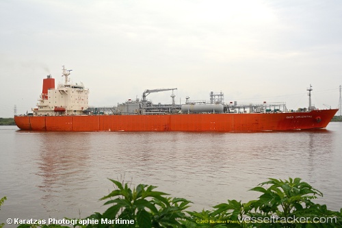
 ROSE GAS
Current Status
Where is the vessel?
ROSE GAS is currently in 40 nm SW of Jodhpur, based on AIS data received about 15h ago.
Latest AIS update:
Current position: 21.55445° N, 69.41987° E (40 nm SW of Jodhpur)
Average speed (last 7 days): Loading…
Average speed (last 30 days): Loading…
Vessel profile: ROSE GAS is a LPG Tanker with dimensions 174m x 28m.
This page combines live AIS, route history, probable destination signals, nearby traffic, and port activity for practical vessel monitoring.
The current position of vessel ROSE GAS is 21.55445 lat / 69.41987 lng. Updated: 2026-05-17 19:35:29 UTCNearest reference points:
- 54 nm S of Positra
- 49 nm S of Positra
- Near Khambhaliya
Currently sailing under the flag of India ![]()
ROSE GAS built in 2003 year
Deadweight:
26534 tDetails:
Live Vessel ROSE GAS Analytics (details, animations, etc.)
Recent AIS points (UTC):
2026-05-17 17:08:28 UTC · 21.55457, 69.42000 · SOG 0.2 kn · COG 309°2026-05-17 18:14:26 UTC · 21.55444, 69.41990 · SOG 0.4 kn · COG 315°
2026-05-17 19:20:29 UTC · 21.55437, 69.41983 · SOG 0.7 kn · COG 319°
2026-05-17 19:35:29 UTC · 21.55445, 69.41987 · SOG 0.1 kn · COG 315°