 vesseltracker.com
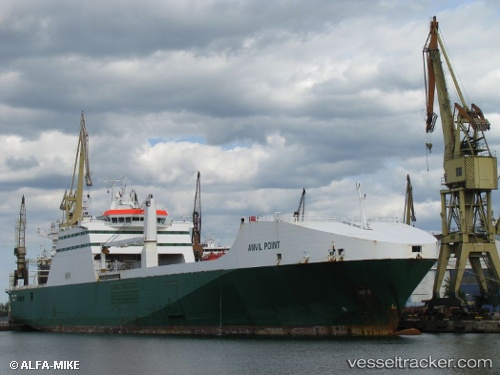
 Anvil Point
Current Status
Where is the vessel?
Anvil Point is currently in 36 nm NW of Alozaina, based on AIS data received about 1h ago.
Latest AIS update:
Current position: 36.95492° N, 15.54495° W (36 nm NW of Alozaina)
Average speed (last 7 days): Loading…
Average speed (last 30 days): Loading…
Vessel profile: Anvil Point is a Ro Ro Cargo Ship with dimensions 193m x 26m.
This page combines live AIS, route history, probable destination signals, nearby traffic, and port activity for practical vessel monitoring.
The current position of vessel Anvil Point is 36.95492 lat / -15.54495 lng. Updated: 2026-05-02 08:18:16 UTCNearest reference points:
- 78 nm W of Nedroma
- 75 nm NE of Nedroma
- 74 nm E of Alozaina
Currently sailing under the flag of United Kingdom ![]()
Anvil Point built in 2003 year
Deadweight:
13274 tDetails:
Live Vessel Anvil Point Analytics (details, animations, etc.)
Recent AIS points (UTC):
2026-05-02 04:55:57 UTC · 36.34074, -15.99211 · SOG 12.8 kn · COG 26°2026-05-02 05:26:14 UTC · 36.43167, -15.92500 · SOG 12 kn · COG -1°
2026-05-02 07:35:46 UTC · 36.82488, -15.64225 · SOG 12.7 kn · COG 28°
2026-05-02 08:18:16 UTC · 36.95492, -15.54495 · SOG 13 kn · COG 29°