 vesseltracker.com
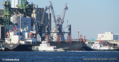
 MARIAM
Current Status
Where is the vessel?
MARIAM is currently in Near KHORFAKKAN, based on AIS data received about 3d ago.
Latest AIS update:
Current position: 25.33929° N, 56.50919° E (Near KHORFAKKAN)
Average speed (last 7 days): Loading…
Average speed (last 30 days): Loading…
Vessel profile: MARIAM is a Bulk Carrier with dimensions 27m x 171m.
This page combines live AIS, route history, probable destination signals, nearby traffic, and port activity for practical vessel monitoring.
The current position of vessel MARIAM is 25.33929 lat / 56.50919 lng. Updated: 2026-05-15 10:22:46 UTCNearest reference points:
- Near KHORFAKKAN
- Near Fujairah
- Near Offshore Fujairah
Currently sailing under the flag of St Vincent and Grenadines ![]()
MARIAM built in 2001 year
Deadweight:
29756 tDetails:
Live Vessel MARIAM Analytics (details, animations, etc.)
Recent AIS points (UTC):
2026-05-15 10:22:46 UTC · 25.33929, 56.50919 · SOG 2.9 kn · COG 100°2026-05-15 10:22:46 UTC · 25.33929, 56.50919 · SOG 2.9 kn · COG 100°
2026-05-15 10:22:46 UTC · 25.33929, 56.50919 · SOG 2.9 kn · COG 100°
2026-05-15 10:22:46 UTC · 25.33929, 56.50919 · SOG 2.9 kn · COG 100°