 vesseltracker.com
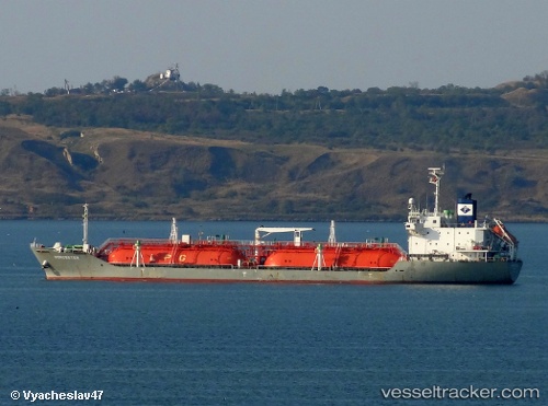
 MONILE
Current Status
Where is the vessel?
MONILE is currently in 12 nm W of Ras Budran, based on AIS data received about 14h ago.
Latest AIS update:
Current position: 28.94491° N, 32.88893° E (12 nm W of Ras Budran)
Average speed (last 7 days): Loading…
Average speed (last 30 days): Loading…
Vessel profile: MONILE is a Lpg Tanker with dimensions m x m.
This page combines live AIS, route history, probable destination signals, nearby traffic, and port activity for practical vessel monitoring.
The current position of vessel MONILE is 28.94491 lat / 32.88893 lng. Updated: 2026-05-18 12:09:01 UTCNearest reference points:
- Near Ras Gharib
- Near Ras Sudr
- Near Al Adabiyah
Currently sailing under the flag of Palau ![]()
Details:
Live Vessel MONILE Analytics (details, animations, etc.)
Recent AIS points (UTC):
2026-05-18 10:31:09 UTC · 28.65183, 33.02509 · SOG 12.3 kn · COG -1°2026-05-18 10:31:09 UTC · 28.65183, 33.02509 · SOG 12.3 kn · COG -1°
2026-05-18 12:09:01 UTC · 28.94491, 32.88893 · SOG 11.3 kn · COG 336°
2026-05-18 12:09:01 UTC · 28.94491, 32.88893 · SOG 11.3 kn · COG 336°