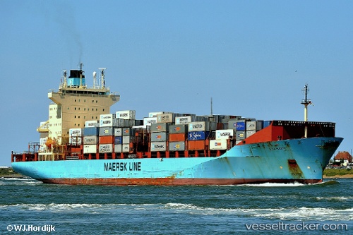
Olga Maersk
Current StatusWhere is the vessel?
Olga Maersk is currently in Open sea (no nearby ports in database), based on AIS data received about 14h ago.
Latest AIS update:
Current position: 15.61733° S, 115.95211° W (Open sea (no nearby ports in database))
Average speed (last 7 days): Loading…
Average speed (last 30 days): Loading…
Vessel profile: Olga Maersk is a Container Ship with dimensions 31m x 237m.
This page combines live AIS, route history, probable destination signals, nearby traffic, and port activity for practical vessel monitoring.
The current position of vessel Olga Maersk is -15.61733 lat / -115.95211 lng. Updated: 2026-05-19 19:30:03 UTCNearest reference points:
- Open sea (no nearby ports in database)
Details:
Live Vessel Olga Maersk Analytics (details, animations, etc.)
Recent AIS points (UTC):
2026-05-19 15:42:16 UTC · -15.20694, -115.08172 · SOG 14.5 kn · COG 242°2026-05-19 16:49:39 UTC · -15.32439, -115.33978 · SOG 14.7 kn · COG 243°
2026-05-19 18:16:27 UTC · -15.48766, -115.66861 · SOG 14.7 kn · COG 244°
2026-05-19 19:30:03 UTC · -15.61733, -115.95211 · SOG 14.6 kn · COG 244°