 GRAND ROYAL EXPRESS
Current Status
Where is the vessel?
GRAND ROYAL EXPRESS is currently in Near BYAH, based on AIS data received about 14h ago.
Latest AIS update:
Current position: 6.95270° S, 106.23931° E (Near BYAH)
Average speed (last 7 days): Loading…
Average speed (last 30 days): Loading…
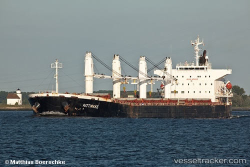
Vessel profile: GRAND ROYAL EXPRESS is a Bulk Carrier with dimensions 32m x 190m.
This page combines live AIS, route history, probable destination signals, nearby traffic, and port activity for practical vessel monitoring.
The current position of vessel GRAND ROYAL EXPRESS is -6.95270 lat / 106.23931 lng. Updated: 2026-05-20 09:47:20 UTCNearest reference points:
- Near Cigading
- Near CILEGON
- Near CIWANDAN
Currently sailing under the flag of Bangladesh ![]()
GRAND ROYAL EXPRESS built in 2002 year
Deadweight:
53146 tDetails:
Live Vessel GRAND ROYAL EXPRESS Analytics (details, animations, etc.)
Recent AIS points (UTC):
2026-05-20 06:05:19 UTC · -6.95269, 106.23928 · SOG 0 kn · COG 307°2026-05-20 07:26:18 UTC · -6.95269, 106.23929 · SOG 0 kn · COG 307°
2026-05-20 07:41:19 UTC · -6.95270, 106.23929 · SOG 0 kn · COG 307°
2026-05-20 09:47:20 UTC · -6.95270, 106.23931 · SOG 0 kn · COG 307°