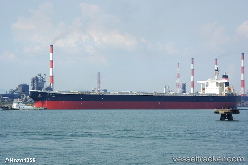
Sunny Link
Current StatusWhere is the vessel?
Sunny Link is currently in Near Port de Boké, based on AIS data received about 14h ago.
Latest AIS update:
Current position: 10.39991° N, 14.81548° W (Near Port de Boké)
Average speed (last 7 days): Loading…
Average speed (last 30 days): Loading…
Vessel profile: Sunny Link is a Bulk Carrier with dimensions 45m x 289m.
This page combines live AIS, route history, probable destination signals, nearby traffic, and port activity for practical vessel monitoring.
The current position of vessel Sunny Link is 10.39991 lat / -14.81548 lng. Updated: 2026-06-25 20:22:20 UTCNearest reference points:
- Near Port de Boké
- 14 nm S of Port de Boké
- Near Dougoula
Details:
Live Vessel Sunny Link Analytics (details, animations, etc.)
Recent AIS points (UTC):
2026-06-25 16:34:19 UTC · 10.40074, -14.81433 · SOG 0.1 kn · COG 175°2026-06-25 17:26:07 UTC · 10.40074, -14.81443 · SOG 0 kn · COG -1°
2026-06-25 19:52:20 UTC · 10.40065, -14.81353 · SOG 0.1 kn · COG 190°
2026-06-25 20:22:20 UTC · 10.39991, -14.81548 · SOG 0.4 kn · COG 134°