 CHANG YANG JIN HAI
Current Status
Where is the vessel?
CHANG YANG JIN HAI is currently in 85 nm NW of Jolo, based on AIS data received about 14h ago.
Latest AIS update:
Current position: 7.17917° N, 120.13542° E (85 nm NW of Jolo)
Average speed (last 7 days): Loading…
Average speed (last 30 days): Loading…
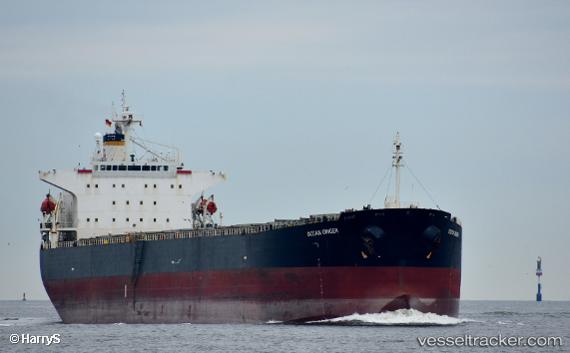
Vessel profile: CHANG YANG JIN HAI is a Bulk Carrier with dimensions 32m x 225m.
This page combines live AIS, route history, probable destination signals, nearby traffic, and port activity for practical vessel monitoring.
The current position of vessel CHANG YANG JIN HAI is 7.17917 lat / 120.13542 lng. Updated: 2026-05-19 05:01:04 UTCNearest reference points:
- 66 nm W of Jolo
- 21 nm NW of Zamboanga
- 14 nm SE of Zamboanga
Currently sailing under the flag of Liberia ![]()
CHANG YANG JIN HAI built in 2002 year
Deadweight:
75735 tDetails:
Live Vessel CHANG YANG JIN HAI Analytics (details, animations, etc.)
Recent AIS points (UTC):
2026-05-19 02:01:47 UTC · 6.65720, 119.99692 · SOG 11 kn · COG -1°2026-05-19 02:01:47 UTC · 6.65720, 119.99692 · SOG 11 kn · COG -1°
2026-05-19 03:35:56 UTC · 6.93654, 120.05370 · SOG 11 kn · COG -1°
2026-05-19 05:01:04 UTC · 7.17917, 120.13542 · SOG 10.5 kn · COG -1°