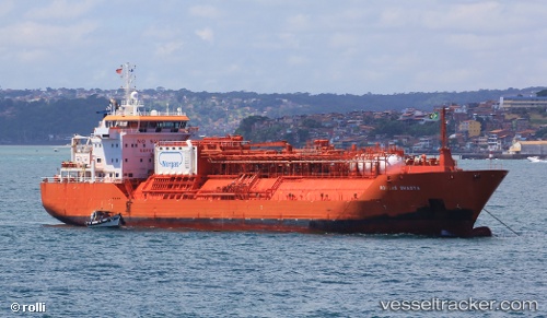
 CORAL SHASTA
Current Status
Where is the vessel?
CORAL SHASTA is currently in Near San Marco in Lamis, based on AIS data received about 58d ago.
Latest AIS update:
Current position: 41.66184° N, 15.61145° E (Near San Marco in Lamis)
Average speed (last 7 days): Loading…
Average speed (last 30 days): Loading…
Vessel profile: CORAL SHASTA is a Lpg Tanker with dimensions m x m.
This page combines live AIS, route history, probable destination signals, nearby traffic, and port activity for practical vessel monitoring.
The current position of vessel CORAL SHASTA is 41.66184 lat / 15.61145 lng. Updated: 2026-05-11 01:58:20 UTCNearest reference points:
- Near TERMOLI
- 26 nm N of Isole Tremiti
- Near Salerno
Currently sailing under the flag of Liberia ![]()
Details:
Live Vessel CORAL SHASTA Analytics (details, animations, etc.)
Recent AIS points (UTC):
2026-05-11 01:58:20 UTC · 41.66184, 15.61145 · SOG 65 kn · COG 221°