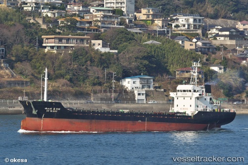
 AYSTAR
Current Status
Where is the vessel?
AYSTAR is currently in 49 nm E of Sallum, based on AIS data received about 15h ago.
Latest AIS update:
Current position: 31.72138° N, 26.08875° E (49 nm E of Sallum)
Average speed (last 7 days): Loading…
Average speed (last 30 days): Loading…
Vessel profile: AYSTAR is a Cargo with dimensions m x m.
This page combines live AIS, route history, probable destination signals, nearby traffic, and port activity for practical vessel monitoring.
The current position of vessel AYSTAR is 31.72138 lat / 26.08875 lng. Updated: 2026-05-19 15:29:20 UTCNearest reference points:
- 91 nm SE of Polychnitos Lesvou
- 67 nm S of Kali Limenes
Currently sailing under the flag of Tuvalu ![]()
Details:
Live Vessel AYSTAR Analytics (details, animations, etc.)
Recent AIS points (UTC):
2026-05-19 11:57:38 UTC · 31.67062, 26.53717 · SOG 6.3 kn · COG 287°2026-05-19 13:23:18 UTC · 31.70003, 26.35973 · SOG 5.8 kn · COG 276°
2026-05-19 14:24:06 UTC · 31.70721, 26.23012 · SOG 6.7 kn · COG 280°
2026-05-19 15:29:20 UTC · 31.72138, 26.08875 · SOG 6.7 kn · COG 281°