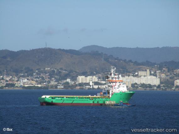
Viking Surf
Current StatusWhere is the vessel?
Viking Surf is currently in 22 nm E of PONTA UBU, based on AIS data received about 14h ago.
Latest AIS update:
Current position: 20.69723° S, 40.19561° W (22 nm E of PONTA UBU)
Average speed (last 7 days): Loading…
Average speed (last 30 days): Loading…
Vessel profile: Viking Surf is a Offshore Tug Supply Ship with dimensions 16m x 70m.
This page combines live AIS, route history, probable destination signals, nearby traffic, and port activity for practical vessel monitoring.
The current position of vessel Viking Surf is -20.69723 lat / -40.19561 lng. Updated: 2026-05-24 19:56:07 UTCNearest reference points:
- Near Tubarão Pt./Vitória
- Near JARDIM CAMBURI
- Near BAIA DE VITORIA
Details:
Live Vessel Viking Surf Analytics (details, animations, etc.)
Recent AIS points (UTC):
2026-05-24 16:37:19 UTC · -21.16167, -40.13667 · SOG 8 kn · COG -1°2026-05-24 18:01:20 UTC · -20.96167, -40.14667 · SOG 8 kn · COG -1°
2026-05-24 18:57:36 UTC · -20.83864, -40.16730 · SOG 8.3 kn · COG -1°
2026-05-24 19:56:07 UTC · -20.69723, -40.19561 · SOG 7.9 kn · COG 359°