 vesseltracker.com
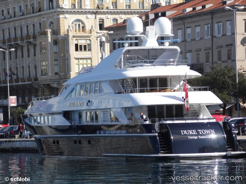
 DUKE TOWN
Current Status
Where is the vessel?
DUKE TOWN is currently in Near Rhodes, based on AIS data received less than 1h ago.
Latest AIS update:
Current position: 36.56386° N, 28.24502° E (Near Rhodes)
Average speed (last 7 days): Loading…
Average speed (last 30 days): Loading…
Vessel profile: DUKE TOWN is a Houseboat with dimensions 37m x 7m.
This page combines live AIS, route history, probable destination signals, nearby traffic, and port activity for practical vessel monitoring.
The current position of vessel DUKE TOWN is 36.56386 lat / 28.24502 lng. Updated: 2026-05-13 19:16:30 UTCNearest reference points:
- Near Içmeler
- Near Rhodes
- Near BOZBURUN
Currently sailing under the flag of Marshall Islands ![]()
DUKE TOWN built in 2002 year
Deadweight:
180 tDetails:
Live Vessel DUKE TOWN Analytics (details, animations, etc.)
Recent AIS points (UTC):
2026-05-13 16:25:36 UTC · 36.67923, 28.90594 · SOG 7.3 kn · COG 178°2026-05-13 17:11:45 UTC · 36.57935, 28.82580 · SOG 13.5 kn · COG 266°
2026-05-13 18:17:18 UTC · 36.57295, 28.52466 · SOG 13.3 kn · COG 265°
2026-05-13 19:16:30 UTC · 36.56386, 28.24502 · SOG 14.3 kn · COG 261°