 FURIA
FURIA
Current Status
Where is the vessel?
FURIA is currently in Near Trelleborg, based on AIS data received about 15h ago.
Latest AIS update:
Current position: 55.20451° N, 13.18475° E (Near Trelleborg)
Average speed (last 7 days): Loading…
Average speed (last 30 days): Loading…
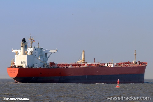
Vessel profile: FURIA is a Crude Oil Tanker with dimensions 247m x 42m.
This page combines live AIS, route history, probable destination signals, nearby traffic, and port activity for practical vessel monitoring.
The current position of vessel FURIA is 55.20451 lat / 13.18475 lng. Updated: 2026-05-20 23:26:23 UTCNearest reference points:
- Near Trelleborg
- Near Oxie
- Near Skanör
Currently sailing under the flag of Sierra Leone ![]()
FURIA built in 2002 year
Deadweight:
104996 tDetails:
Live Vessel FURIA Analytics (details, animations, etc.)
Recent AIS points (UTC):
2026-05-20 19:04:22 UTC · 55.57149, 12.70372 · SOG 7.7 kn · COG 174°2026-05-20 22:05:03 UTC · 55.24699, 12.83644 · SOG 9.1 kn · COG 111°
2026-05-20 23:06:23 UTC · 55.21022, 13.09800 · SOG 9.1 kn · COG 97°
2026-05-20 23:26:23 UTC · 55.20451, 13.18475 · SOG 8.3 kn · COG 95°