 Santa Cruz I
Current Status
Where is the vessel?
Santa Cruz I is currently in 37 nm NE of Kampung Tanjung Langsat, based on AIS data received about 15h ago.
Latest AIS update:
Current position: 1.91377° N, 104.44720° E (37 nm NE of Kampung Tanjung Langsat)
Average speed (last 7 days): Loading…
Average speed (last 30 days): Loading…
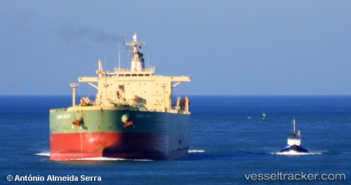
Vessel profile: Santa Cruz I is a Crude Oil Tanker with dimensions 239m x 38m.
This page combines live AIS, route history, probable destination signals, nearby traffic, and port activity for practical vessel monitoring.
The current position of vessel Santa Cruz I is 1.91377 lat / 104.44720 lng. Updated: 2026-05-19 04:08:33 UTCNearest reference points:
- 47 nm NE of PENGERANG
- 52 nm NE of PENGERANG
- 45 nm NE of PENGERANG
Currently sailing under the flag of Liberia ![]()
Santa Cruz I built in 2002 year
Deadweight:
84999 tDetails:
Live Vessel Santa Cruz I Analytics (details, animations, etc.)
Recent AIS points (UTC):
2026-05-19 02:05:35 UTC · 1.93405, 104.45288 · SOG 0.3 kn · COG 268°2026-05-19 02:13:54 UTC · 1.93342, 104.45212 · SOG 0.4 kn · COG 263°
2026-05-19 03:38:14 UTC · 1.92078, 104.44818 · SOG 0.7 kn · COG 244°
2026-05-19 04:08:33 UTC · 1.91377, 104.44720 · SOG 0.9 kn · COG 221°