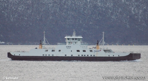
 Eira
Eira
Current Status
Where is the vessel?
Eira is currently in Near Aukra, based on AIS data received about 14h ago.
Latest AIS update:
Current position: 62.71894° N, 6.93900° E (Near Aukra)
Average speed (last 7 days): Loading…
Average speed (last 30 days): Loading…
Vessel profile: Eira is a Passenger Ro Ro Cargo Ship with dimensions 84m x 16m.
This page combines live AIS, route history, probable destination signals, nearby traffic, and port activity for practical vessel monitoring.
The current position of vessel Eira is 62.71894 lat / 6.93900 lng. Updated: 2026-05-21 07:11:02 UTCNearest reference points:
- Near Aukra
- Near ELNESVAGEN
- Near Brattvåg
Currently sailing under the flag of Norway ![]()
Eira built in 2002 year
Deadweight:
655 tDetails:
Live Vessel Eira Analytics (details, animations, etc.)
Recent AIS points (UTC):
2026-05-21 04:05:09 UTC · 62.72385, 6.95715 · SOG 9.6 kn · COG 58°2026-05-21 04:29:57 UTC · 62.71952, 6.94127 · SOG 3.9 kn · COG 237°
2026-05-21 05:57:31 UTC · 62.72738, 6.97118 · SOG 11.1 kn · COG 62°
2026-05-21 07:11:02 UTC · 62.71894, 6.93900 · SOG 1.5 kn · COG 297°