 ATILA
ATILA
Current Status
Where is the vessel?
ATILA is currently in 172 nm SW of Veraval, based on AIS data received about 16h ago.
Latest AIS update:
Current position: 18.88833° N, 68.17500° E (172 nm SW of Veraval)
Average speed (last 7 days): Loading…
Average speed (last 30 days): Loading…
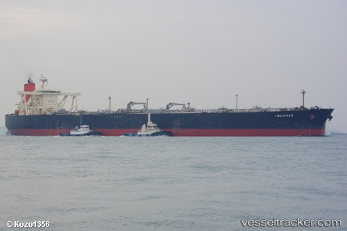
Vessel profile: ATILA is a Crude Oil Tanker with dimensions 60m x 333m.
This page combines live AIS, route history, probable destination signals, nearby traffic, and port activity for practical vessel monitoring.
The current position of vessel ATILA is 18.88833 lat / 68.17500 lng. Updated: 2026-05-20 17:46:24 UTCNearest reference points:
- 236 nm SW of Veraval
- 306 nm SW of Veraval
Currently sailing under the flag of Cameroon ![]()
ATILA built in 2003 year
Deadweight:
300667 tDetails:
Live Vessel ATILA Analytics (details, animations, etc.)
Recent AIS points (UTC):
2026-05-20 13:33:02 UTC · 18.81667, 68.11167 · SOG 1 kn · COG -1°2026-05-20 15:21:34 UTC · 18.84667, 68.13500 · SOG 1 kn · COG -1°
2026-05-20 16:46:06 UTC · 18.87333, 68.15667 · SOG 1 kn · COG -1°
2026-05-20 17:46:24 UTC · 18.88833, 68.17500 · SOG 1 kn · COG -1°