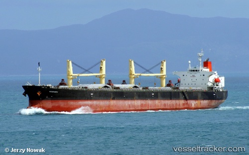
Ocean Hiryu
Current StatusWhere is the vessel?
Ocean Hiryu is currently in 107 nm E of Puerto Princesa, based on AIS data received about 16h ago.
Latest AIS update:
Current position: 9.18447° N, 120.44077° E (107 nm E of Puerto Princesa)
Average speed (last 7 days): Loading…
Average speed (last 30 days): Loading…
Vessel profile: Ocean Hiryu is a Bulk Carrier with dimensions 32m x 188m.
This page combines live AIS, route history, probable destination signals, nearby traffic, and port activity for practical vessel monitoring.
The current position of vessel Ocean Hiryu is 9.18447 lat / 120.44077 lng. Updated: 2026-05-20 22:43:18 UTCNearest reference points:
- 35 nm SE of Brookes Point, Palawan
- 21 nm NW of Zamboanga
- Near Iloilo
Details:
Live Vessel Ocean Hiryu Analytics (details, animations, etc.)
Recent AIS points (UTC):
2026-05-20 22:43:18 UTC · 9.18447, 120.44077 · SOG 10 kn · COG 12°2026-05-20 22:43:18 UTC · 9.18447, 120.44077 · SOG 10 kn · COG 12°
2026-05-20 22:43:18 UTC · 9.18447, 120.44077 · SOG 10 kn · COG 12°
2026-05-20 22:43:18 UTC · 9.18447, 120.44077 · SOG 10 kn · COG 12°