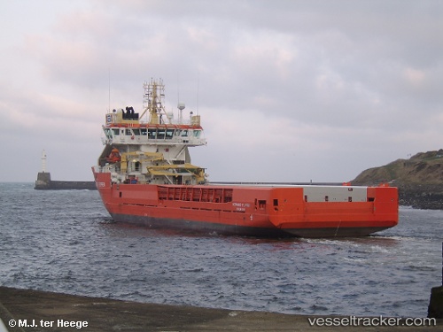
 HM FLIPPER
Current Status
Where is the vessel?
HM FLIPPER is currently in Near Bridge of Don, based on AIS data received about 14h ago.
Latest AIS update:
Current position: 57.19210° N, 2.02205° W (Near Bridge of Don)
Average speed (last 7 days): Loading…
Average speed (last 30 days): Loading…
Vessel profile: HM FLIPPER is a Multi Purpose Offshore Vessel with dimensions m x m.
This page combines live AIS, route history, probable destination signals, nearby traffic, and port activity for practical vessel monitoring.
The current position of vessel HM FLIPPER is 57.19210 lat / -2.02205 lng. Updated: 2026-05-20 00:07:39 UTCNearest reference points:
- Near Aberdeen
- Near PETERHEAD
- Near Peterhead
Currently sailing under the flag of Bahamas ![]()
Details:
Live Vessel HM FLIPPER Analytics (details, animations, etc.)
Recent AIS points (UTC):
2026-05-19 19:47:04 UTC · 57.19214, -2.02156 · SOG 0.8 kn · COG 163°2026-05-19 22:13:07 UTC · 57.19167, -2.02167 · SOG 0 kn · COG -1°
2026-05-19 23:05:27 UTC · 57.19205, -2.02228 · SOG 0.9 kn · COG 143°
2026-05-20 00:07:39 UTC · 57.19210, -2.02205 · SOG 0.6 kn · COG 138°