 MERIOS
Current Status
Where is the vessel?
MERIOS is currently in Near Canakkale, based on AIS data received about 14h ago.
Latest AIS update:
Current position: 40.15318° N, 26.39279° E (Near Canakkale)
Average speed (last 7 days): Loading…
Average speed (last 30 days): Loading…
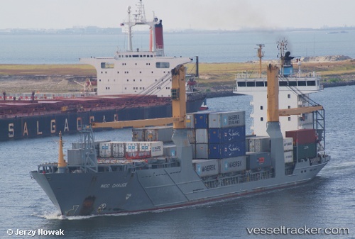
Vessel profile: MERIOS is a Container Ship with dimensions m x m.
This page combines live AIS, route history, probable destination signals, nearby traffic, and port activity for practical vessel monitoring.
The current position of vessel MERIOS is 40.15318 lat / 26.39279 lng. Updated: 2026-05-20 19:32:59 UTCNearest reference points:
- Near Akcansa
- Near Dardanelles
- 10 nm W of Akcansa
Currently sailing under the flag of Barbados ![]()
Details:
Live Vessel MERIOS Analytics (details, animations, etc.)
Recent AIS points (UTC):
2026-05-20 15:55:19 UTC · 39.81337, 25.87644 · SOG 9.2 kn · COG 11°2026-05-20 16:10:58 UTC · 39.85300, 25.88534 · SOG 9.3 kn · COG 11°
2026-05-20 18:05:41 UTC · 40.01597, 26.16671 · SOG 9 kn · COG 77°
2026-05-20 19:32:59 UTC · 40.15318, 26.39279 · SOG 10.8 kn · COG 353°