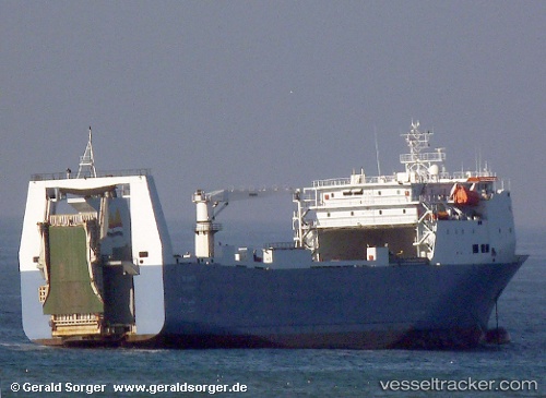
Al Hurreya
Current StatusWhere is the vessel?
Al Hurreya is currently in Near SAFAGA, based on AIS data received about 15h ago.
Latest AIS update:
Current position: 26.74444° N, 33.94737° E (Near SAFAGA)
Average speed (last 7 days): Loading…
Average speed (last 30 days): Loading…
Vessel profile: Al Hurreya is a Ro Ro Cargo Ship with dimensions 24m x 140m.
This page combines live AIS, route history, probable destination signals, nearby traffic, and port activity for practical vessel monitoring.
The current position of vessel Al Hurreya is 26.74444 lat / 33.94737 lng. Updated: 2026-05-22 07:49:47 UTCNearest reference points:
- Near Bur Safaga
- Near El-Guna (El Gouna)
- 19 nm SE of Zeit Bay
Details:
Live Vessel Al Hurreya Analytics (details, animations, etc.)
Recent AIS points (UTC):
2026-05-22 04:10:09 UTC · 26.98183, 34.56362 · SOG 13.7 kn · COG 241°2026-05-22 06:19:19 UTC · 26.73203, 34.08838 · SOG 13.8 kn · COG 241°
2026-05-22 07:20:00 UTC · 26.74410, 33.94774 · SOG 0.4 kn · COG 140°
2026-05-22 07:49:47 UTC · 26.74444, 33.94737 · SOG 0 kn · COG 140°