 Kakuto Maru
Current Status
Where is the vessel?
Kakuto Maru is currently in Near Chibai, based on AIS data received about 14h ago.
Latest AIS update:
Current position: 35.49555° N, 139.97282° E (Near Chibai)
Average speed (last 7 days): Loading…
Average speed (last 30 days): Loading…
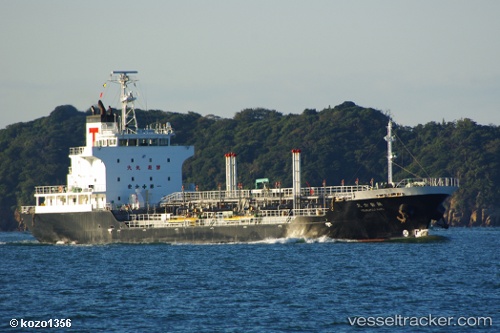
Vessel profile: Kakuto Maru is a Oil Products Tanker with dimensions 105m x 16m.
This page combines live AIS, route history, probable destination signals, nearby traffic, and port activity for practical vessel monitoring.
The current position of vessel Kakuto Maru is 35.49555 lat / 139.97282 lng. Updated: 2026-05-20 11:24:49 UTCNearest reference points:
- Near ANEGASAKI
- Near Aomi
- Near Kawasaki
Currently sailing under the flag of Japan ![]()
Details:
Live Vessel Kakuto Maru Analytics (details, animations, etc.)
Recent AIS points (UTC):
2026-05-20 07:51:49 UTC · 35.49538, 139.97404 · SOG 0 kn · COG 219°2026-05-20 10:03:49 UTC · 35.49560, 139.97372 · SOG 0.1 kn · COG 196°
2026-05-20 10:09:49 UTC · 35.49550, 139.97385 · SOG 0 kn · COG 203°
2026-05-20 11:24:49 UTC · 35.49555, 139.97282 · SOG 0 kn · COG 152°