 Sea Holly
Current Status
Where is the vessel?
Sea Holly is currently in Near Gonglu, based on AIS data received about 224d ago.
Latest AIS update:
Current position: 31.27098° N, 121.85271° E (Near Gonglu)
Average speed (last 7 days): Loading…
Average speed (last 30 days): Loading…
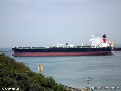
Vessel profile: Sea Holly is a Crude Oil Tanker with dimensions 240m x 42m.
This page combines live AIS, route history, probable destination signals, nearby traffic, and port activity for practical vessel monitoring.
The current position of vessel Sea Holly is 31.27098 lat / 121.85271 lng. Updated: 2025-10-10 14:40:12 UTCNearest reference points:
- Near Gonglu
- 15 nm NE of Gonglu
- 18 nm NE of Nanhui
Currently sailing under the flag of Marshall Is ![]()
Sea Holly built in 2004 year
Deadweight:
106070 tDetails:
Live Vessel Sea Holly Analytics (details, animations, etc.)
Recent AIS points (UTC):
2025-10-10 14:40:12 UTC · 31.27098, 121.85271 · SOG 8.5 kn · COG 112°