 PEARL ORIENT
Current Status
Where is the vessel?
PEARL ORIENT is currently in 43 nm SE of Astorga, based on AIS data received about 15h ago.
Latest AIS update:
Current position: 6.46893° N, 126.04775° E (43 nm SE of Astorga)
Average speed (last 7 days): Loading…
Average speed (last 30 days): Loading…
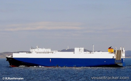
Vessel profile: PEARL ORIENT is a Ro-Ro Cargo Ship with dimensions 160m x 26m.
This page combines live AIS, route history, probable destination signals, nearby traffic, and port activity for practical vessel monitoring.
The current position of vessel PEARL ORIENT is 6.46893 lat / 126.04775 lng. Updated: 2026-05-24 19:24:54 UTCNearest reference points:
- Near DICT / SVT
- 48 nm N of Melonguanne
Currently sailing under the flag of Philippines ![]()
PEARL ORIENT built in 2002 year
Deadweight:
7376 tDetails:
Live Vessel PEARL ORIENT Analytics (details, animations, etc.)
Recent AIS points (UTC):
2026-05-24 16:18:19 UTC · 7.08768, 125.84318 · SOG 12.2 kn · COG 160°2026-05-24 17:51:59 UTC · 6.76613, 125.94380 · SOG 12.4 kn · COG 157°
2026-05-24 19:24:54 UTC · 6.46893, 126.04775 · SOG 12.5 kn · COG -1°
2026-05-24 19:24:54 UTC · 6.46893, 126.04775 · SOG 12.5 kn · COG -1°