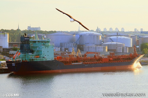
 Kiisla
Current Status
Where is the vessel?
Kiisla is currently in 22 nm NW of Fairport Harbor Village, based on AIS data received about 14h ago.
Latest AIS update:
Current position: 42.03442° N, 81.59055° W (22 nm NW of Fairport Harbor Village)
Average speed (last 7 days): Loading…
Average speed (last 30 days): Loading…
Vessel profile: Kiisla is a Chemical Oil Products Tanker with dimensions 140m x 22m.
This page combines live AIS, route history, probable destination signals, nearby traffic, and port activity for practical vessel monitoring.
The current position of vessel Kiisla is 42.03442 lat / -81.59055 lng. Updated: 2026-05-20 16:42:22 UTCNearest reference points:
- Near Linndale
- Near Scudder
- Near Saint Clair Shores
Currently sailing under the flag of Norway ![]()
Kiisla built in 2004 year
Deadweight:
14750 tDetails:
Live Vessel Kiisla Analytics (details, animations, etc.)
Recent AIS points (UTC):
2026-05-20 13:31:15 UTC · 41.80846, -82.46061 · SOG 12.4 kn · COG 89°2026-05-20 14:00:15 UTC · 41.83735, -82.33296 · SOG 9.7 kn · COG 67°
2026-05-20 16:21:12 UTC · 42.00962, -81.68506 · SOG 12.6 kn · COG 70°
2026-05-20 16:42:22 UTC · 42.03442, -81.59055 · SOG 12.7 kn · COG 70°