 vesseltracker.com
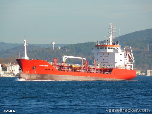
 Alev Kaman
Current Status
Where is the vessel?
Alev Kaman is currently in Near Ayvalik, based on AIS data received less than 1h ago.
Latest AIS update:
Current position: 39.31811° N, 26.48697° E (Near Ayvalik)
Average speed (last 7 days): Loading…
Average speed (last 30 days): Loading…
Vessel profile: Alev Kaman is a Oil Products Tanker with dimensions 93m x 14m.
This page combines live AIS, route history, probable destination signals, nearby traffic, and port activity for practical vessel monitoring.
The current position of vessel Alev Kaman is 39.31811 lat / 26.48697 lng. Updated: 2026-05-17 01:45:10 UTCNearest reference points:
- Near MITHYMNA
- Near Baba Point
- Near Aliaga
Currently sailing under the flag of Turkey ![]()
Alev Kaman built in 2003 year
Deadweight:
3667 tDetails:
Live Vessel Alev Kaman Analytics (details, animations, etc.)
Recent AIS points (UTC):
2026-05-16 22:41:36 UTC · 39.45111, 26.04367 · SOG 7.6 kn · COG 112°2026-05-16 23:21:54 UTC · 39.43783, 26.15176 · SOG 7.7 kn · COG 82°
2026-05-17 01:29:30 UTC · 39.34815, 26.46309 · SOG 8 kn · COG 147°
2026-05-17 01:45:10 UTC · 39.31811, 26.48697 · SOG 8.1 kn · COG 148°