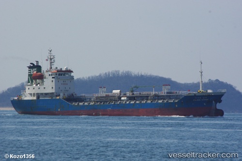
 Pacific Sambu
Current Status
Where is the vessel?
Pacific Sambu is currently in Near Zhangjiagang, based on AIS data received about 15h ago.
Latest AIS update:
Current position: 32.03418° N, 120.47533° E (Near Zhangjiagang)
Average speed (last 7 days): Loading…
Average speed (last 30 days): Loading…
Vessel profile: Pacific Sambu is a Chemical Oil Products Tanker with dimensions 91m x 14m.
This page combines live AIS, route history, probable destination signals, nearby traffic, and port activity for practical vessel monitoring.
The current position of vessel Pacific Sambu is 32.03418 lat / 120.47533 lng. Updated: 2026-07-05 07:51:23 UTCNearest reference points:
- Near Zhangjiagang
- 10 nm N of Zhangjiagang
- Near Jingjiang Pt
Currently sailing under the flag of Korea ![]()
Details:
Live Vessel Pacific Sambu Analytics (details, animations, etc.)
Recent AIS points (UTC):
2026-07-05 04:53:58 UTC · 32.14430, 119.89373 · SOG 12.3 kn · COG 163°2026-07-05 05:37:45 UTC · 32.00782, 119.96815 · SOG 11.3 kn · COG 130°
2026-07-05 07:40:43 UTC · 32.02532, 120.42808 · SOG 14.4 kn · COG 72°
2026-07-05 07:51:23 UTC · 32.03418, 120.47533 · SOG 13.8 kn · COG 96°